Friday, May 31, 2024

Day 48 – Where Eagles Dare (Thursday 30th May 2024)

After a mammoth day behind the wheel yesterday we thought stay closer to home. Also, the Golf was due to be returned by 4:30pm. Good plan, no? The day was wet and dull when we set off bound for Germany. Yes, Germany. Salzburg is tucked in a little corner of Austria not 10 minutes from its border with Germany. Our plan was to drive via Bad Reichenhall(Germany), Schneizlreuth(Germany), Lofer(Austria), Saalfelden(Austria), Bischofshofen(Austria), Werfen(Austria) and back to Salzburg.

Werfen is the town where my favourite Alaistar MacLean novel “Where Eagles Dare” is set. Rising 110m over the northern end of town is the imposing Burg Hohenwerfen. The fortress is very similar to the Hohensalzburg fortress in Salzburg having been constructed in the same era (early 2nd millennium) by the Prince-Archbishops as part of a defensive and controlling network of fortresses in the region. Werfen is just 40 minutes drive to the south of Salzburg, usually, but roadworks were underway on the A10 autobahn which passes directly by the town. We’d been caught up in the roadworks yesterday and seen them from the other side of the road the day before so didn’t fancy spending an extensive amount of time sitting on a road and going nowhere. So, I dreamed up an alternative route which came in the back way from the south, skirting around the very high peaks. The route was necessarily a large anti-clockwise circumnavigation through the limestone mountains that prevail in that area to the south-west of Salzburg. There are no roads across the highest peaks, a feat too difficult for even the best Austrian engineers, only the roads around them. Our “forty minute” drive to Werfen was going to three times that.


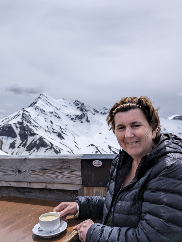
But that didn’t matter because, once again, the scenery was spectacular. Snow-covered peaks soared sharply into the clearing sky high above quaint villages with oh-so-typical Austrian/German houses and public buildings lining the streets. Out of the towns the lush green fields crept up the mountain-sides until they reached the pine forests that eventually had to give-in to the sheer rock walls. Idyllic! Everything you would hope to see in this part of the world. We stopped in the town of Lofer for a wander around town and a coffee and cake for morning tea. The incredible scenery just rolled on and on as we continued our circumnavigation. Low-key, family-oriented skiing is a big part of this region in the winter months. None of your big, bad slopes here, just places where the kids can have fun and learn to ski. Guesthouses to accommodate the visitors abound. The last 40 minutes from Maria Alm to Bischofshofen was particularly challenging for the driver. First up a wet, winding mountain road then down the other side and then along the Muhlbach following every one of its twists and turns. I was glad when we reached Bischofshofen. I wasn’t glad when GPS-man eschewed the back road into Werfen in favour of the A10 and its roadworks because it was a few hundred metres shorter to go that way!! The roadworks weren’t anywhere near as bad as those that were stopping the traffic coming from the north but bad enough, coupled with our now significantly diminished time budget due to the longer than anticipated drive around the high peaks, to dispense with a visit to Burg Hohenwerfen. We stopped in Werfen long enough to get a photo of the castle from the train station and then moved on. The A10 could not be entered from Werfen so all the traffic bound for Salzburg was diverted through a stunning, narrow chasm between two mountains. The chasm has been cut by the river Salzach on its way to Salzburg. We eventually made it back to Salzburg and dripped the car off just before 2:30pm.


I learned after the fact that many of the town scenes in “Where Eagles Dare” were filmed in Lofer, which we had stopped at earlier in the day. Other scenes were filmed in the Salzkammergut where we’d been yesterday. If you ever get to see this landscape you will understand why the title of Alistair MacLean’s novel is so apt.


The bus back into town passed a temporary market outside the Mirabell Palace so we got off to explore. It was mid-afternoon and we’d had little to eat all day so we grabbed a couple of breads from the Italian-themed market and found a shady seat in the Palace gardens to eat and enjoy the gardens once again. By now the sky was sunny and blue making the Hohensalzburg Fortress in the distance look better than ever. Since we were so close, a photograph on the famous “Do, Re, Mi” steps in the garden was a must. Back along the Salzach we strolled to the No. 28 bus and home to prepare for our long train journey tomorrow.


Day 47 – Grossglockner (Wednesday 29th May 2024)

Hang on! Let me have another look. Maybe in the bottom of the backpack?! No, can’t find any there. Oh well! Sorry folks, but I’ve run out of superlatives to describe the sights and the vistas we were privileged to see today. I hoped that today’s travels would be a highlight of the whole trip and I haven’t been let down.


Billed as the most magnificent drive in the whole of Europe (some claim, the World), the Grossglockner High Alpine Road lived up to every expectation we had and every description we read. It’s a twisting, turning road of 48kms from Fusch in the north to Heiligenblut am Grossglockner in the south. The accessibility to the places we visited is a credit to the engineers and workers who built this exceptional road across the mountains. In August 1930 construction of the road, the primary purpose of which was automotive tourism, was started. The government covered the cost as an avenue for the employment of 3,200 Austrians who were still suffering with post-WWI blues and in the depths of the Great Depression. The government’s outlay would be reimbursed by a toll on the road. Five years later the road was opened. Almost 90 years after that there’s still a toll on the road - 43.00 per car – but, believe me, at a little under 1.00/km it’s worth every Euro!


This serpentine road is definitely built for tourists. The road is wide, the road surface is first quality and hundred metres or so there are places to easily, quickly and safely pull over for a photograph of yet another magnificent vista. The road is shared with buses (not very many), motorcyclists and bicyclist. I have to admire the commitment of those men and women who are out there on their push-bikes emulating the fears of the Giro d’Italia cyclists of 1971 and 2011. Probably the best way to do the road, with plenty of time to take in the scenery. Although the strain and looks of exhaustion on the faces of some of the riders might provide another view in that.


We stopped countless times on the way up and the way down with the highlight being the 1.5km detour up the Edelweißspitze (2,572m) for a 360 degree panoramic view. In view are over 30 pealk that breach 3,000m in altitude. The drive up and the wonderful panoramic view when you get there is not dissimilar to the drive up to Mt. Mackay (1842m) near Falls Creek, the highest point in Australia that’s reachable by car, except that you can get a beer or a coffee or a strudel on Edelweißspitze! The Hochter Pass, just near Edelweißspitze, represents the top of the climb. The road only opens in early May and closes in October.

Being late May, the landscape, both near and distant is still is copious amounts of snow and ice. Snow-ploughs are still required to keep the road open at this time of year. For us, the weather was perfect. It could not have been better. Mostly blue sky and sunshine, no chilly winds with the odd fluffy white cloud cresting the mountain tops. In a carpark near Hochter Pass we found a wooden table with bench seats and enjoyed lunch in the most awe-inspiring setting.


Down the other side of the Pass the road-side snow seemed to be even more prevalent. Snow-covered hill-sides greeted at every hair-pin bend in the road. A number of times we drove through walls of ice 10m high gracing either edge of the road. A quite surreal driving experience. We came upon the detour to the Pasterze Glacier (at 3,453m), a fifteen minute drive off the main road. Here we found the 8km long glacier at the foot of high, rocky ridge that led to Grossglockner, Austria’s highest mountain at 3,798m. We stopped for some refreshment (an ice cream, not a coffee!) and to have a short break before continuing the descent, eventually arriving in Heiligenblut am Grossglockner but not before finding a place to so stop and take a photo of the green valley below, wedged between two enormous mountainsides.


The journey home took us down another long, green valley dotted with town and villages along the way. At one point we caught view of the craggy peaks of the Dolomites on the border between Austria and Italy. We hit the A10 autobahn north to Salzburg with still about 150kms to go, arriving home at about 7:00pm.

Anyway, enough words. I'll let the pictures do the talking.....


Wednesday, May 29, 2024

Day 46 – Salzkammergut (Tuesday 28th May 2024)

Time to explore the regions surrounding Salzburg. To do that, we visited the Sixt Car Rental office in the east of Salzburg to pick-up a car I’d booked just a couple of days ago. We’d always planned to get car, just hadn’t got around to working out exactly how long we’d want it for. On Sunday night we mapped that out.


The weather was lousy. Rain was forecast and the rain came. Just before 8:00am we caught the No. 9 bus and changed top the No.12 bus to get to the Sixt office. This was a new route for us but as expected it all executed very smoothly dropping us right at the corner of the street the Sixt office is on. We’d nominally booked a VW T-Cross SUV but, as is always the case, we didn’t get that. Instead we got a current model white, manual, diesel VW Golf which I was more than happy to take as an alternative. When the paper work was done we walked across the road and found our car and sat there for 15 minutes getting to know it a little. The chap who served us didn’t venture into the rain to help us get going, which will be a bit of a minus for him in review to come. The first and most important job was to work out how to change the German language system controls to English so we could at least set the SatNav to our first destination. Everything is managed via the touch screen so we poked this and prodded that in different sequence until I pressed a button that looked like it was to do with language selection, which it turned out to be. I set the computer to English and it was all very straightforward from there. An episode like that really reinforces the importance of the universal “symbol” language that all cultures use. I’ve got no idea of the word for SETUP in German but I recognised the “cog” symbol.

Last night I’d put together a rough plan for a circumnavigation we’d do for the day, just listing the towns that looked interesting or took us to an area that looked interesting, in the region known as the Salzkammergut. The Salzkammergut is the area immediately to the east of Salzburg, the heart of which is just 45 – 60 minutes drive away. It’s a land of beautiful lakes surrounded by rugged, high mountains. It’s the area that made Salzburg rich as it’s from here that the precious commodity of salt was mined for centuries. In case you haven’t work it out already the “salz” in Salzburg, Salzach and Salzkammegut means salt.


Our first stop was the town of Mondsee on the shores of the lake by the same name. BTW, “See” in German means lake. The weather had worsened and their were serious roadworks along the thirty mintue drive along the A1. If I can survive such an introduction I can survive anything, I reasoned. We were in Mondsee for nothing to do with salt. My investigations last night had uncovered the fact that St. Michael’s Church was the location at which they shot the wedding of Maria and Georg in “The Sound of Music”. A “must not miss” for fans of the movie like Kerry. The Roman Catholic church is a good example of Gothic architecture even down to it’s very dark interior, which was aided greatly by very dull day. We got some cash, got out of the rain at a cafe and then walked down to the pretty lake before moving into our next destination at Schorfling am Attersee a town that sits at the top of a lake called Attersee. I couldn’t be sure if the car’s tank was full or almost empty so we had some fun finding a petrol station and after squeezing in three litres, determined it was full.


As we hugged the shoreline of Attersee heading for Bad Ischi the mountains became taller and their tops were lost in the clouds. A car-park on the roadside near the hamlet of Steinbach am Attersee provided a place for our simple lunch of ham and salad rolls, the ingredients for which we’d bought at a supermarket in Seewalchen am Attersee. The rain had begun to ease a little by now and I think the sky was brightening just a tad also. We moved on through Bad Ischi setting the GPS for the village of Obertraun on the southern end of Hallstätter See – probably the “star” lake of the district.


To get to Obertraun we drove around the town of Hallstatt even though that town was our primary target. Why so, I hear you say? Simple. Approaching Hallstatt is best done from a boat sailing across the waters of Hallstätter See. From here one can truly appreciate the majesty of the enormous mountains that encircle the beautiful lake. The best boat leaves from Obertraun, travels up the eastern shoreline well past the Hallstatt railway station boat dock, across the lake and then proceeds down the western shoreline to the Hallstatt dock – a journey of about 25 minutes. Not cheap at 15.00 return ea. But worth the money for such a superb view. The mountains in this part of the Salzkammergut are particularly tall. Sheer rock walls plummet into the lake from great heights on all sides. The dull and cloudy day added some mystique to the whole scene with many of the mountains tops lost in the clouds while on other mountain sides small clouds hung in the air low enough to reveal the peak above.


The little village of Hallstatt is a picture postcard town hugging the western shoreline of the lake and somewhat reminiscent of Walhalla in that much of the town is built on impossibly steep slopes. A small but majestic Protestant church by the dock with it’s pencil thin tall tower dominates the town’s skyline. The Roman Catholic church is much larger, holding a commanding position part-way up the hillside. The beautifully coloured houses and shops fill the cobblestone lanes that follow the contours of the land. Everywhere there are steps leading into places unknown. A fast flowing stream races down the hillside from above, in and out and under the buildings and lanes emptying into the lake by the church. At the southern end of the village is a funicular that takes visitors up the the old salt mine (now a gold mine, I suspect), a huge ice cave, hiking trails and viewpoints that offer splendid vistas across the whole of the region. We did none of that given the weather and our need to catch the last boat back to Obertraun at 4:00pm.


From Obertraun we circled back past Hallstatt and drove along the 166 route through Gosau and towards the A10 autobahn. At the hamlet of Lammerer GPS-man (yes, that’s right Janine, she’s been usurped in Austria) ordered an abrupt right-hand turn of a perfectly good main road to take us along the 3km shorter path through the Moselberg valley and along its namesake river. It was beautiful drive though a lovely setting of small farms, rolling green fields and local people going about their business. A great diversion.


Thirty minutes later we hit the A10 and sped along the autobahn to Salzburg, approaching from the south. GPS-man redeemed himself by finding a way to our hotel completely avoiding having to go anywhere near the main town itself, exiting the autobahn just a few minutes from home.


Day 67 – Back home to Bendigo (Tuesday 18th June 2024)

Our journey was almost complete. The Great Southern room was very comfortable, clean, fresh and modern. I highly recommend it for a good va...